|
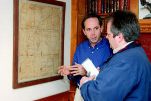
President of the Emmitsburg Area Historical Society, Michael Hillman (Left), explains the historical importance of land boundaries that are captured in this 1797 map. In a
presentation to the Emmitsburg Board of Commissioners slated to take place
Jan. 17, Hillman, on behalf of the historical society, plans to return the
map to the town. |
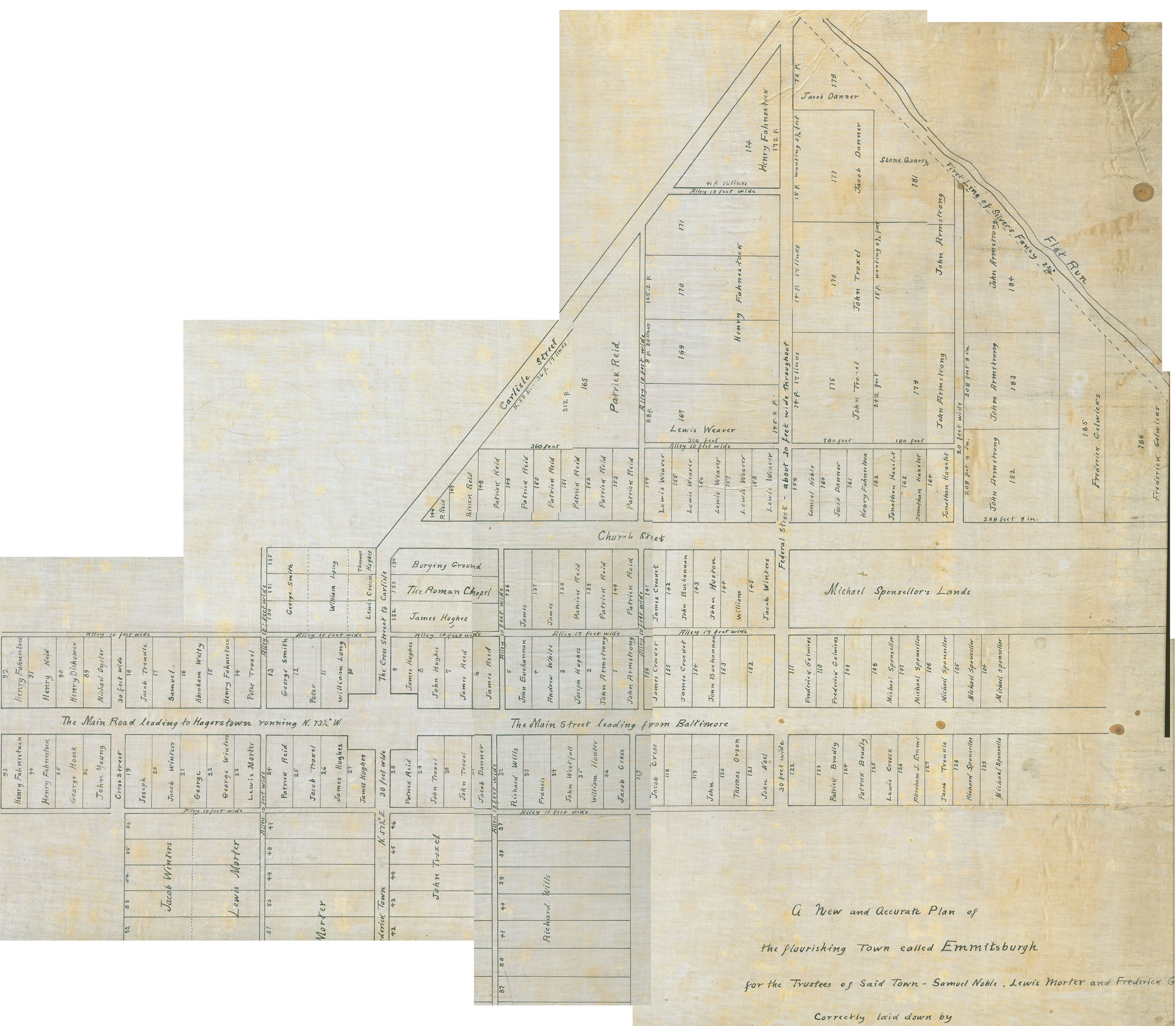
(1/5) It is a map that could get you anywhere
around 1797 "Emmitsburgh," and now it has finally found its way to the
Emmitsburg town office.
Emmitsburg Commissioner Glenn Blanchard asked that
Michael Hillman
be placed on the commissioner's agenda for Jan. 17 so that he could present a
historic map to the town.
"This is the oldest map that shows the boundaries of
Emmitsburg that existed in 1797," Hillman said during an interview later.
Blanchard said he had seen the map and "It's just very
cool. I'll leave it at that."
The poster-sized map now hangs in a frame in Hillman's
home. It is drawn on linen paper that has turned brown and cracked and torn
with age. It shows not only the Town of Emmitsburg as it existed in 1797 but
the town lots, roads and property lines of surrounding properties. For
instance, it shows that a large part of the town that the Emmit family believed
they owned as part of the Carrollsburg tract was actually part of a tract of
land called Silver Fancy owned by the Delaney family.
"There
was a boundary dispute over who owned the land where the town was so the court
ordered a resurvey," Hillman said. "The result of that survey was this
map in 1797."
|
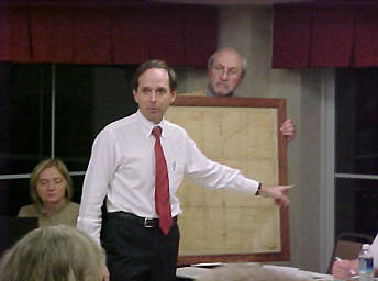
The last time this historical artifact, a
1797 map, was displayed before the town board was on Feb. 3, 2003 when
Michael Hillman used it in his presentation to argue his point that the
1757 founding date listed on the then town’s welcome signs was in error.
-File Photo RAYMOND BUCHHEISTER / THE DISPATCH
|
Though the map has been a prized possession of
Hillman's for a number of years, he said it really belongs to the town and he
would like to see it hang where a lot of people can view it.
"As long as the town said it was founded in 1757, this
was worthless to the town," Hillman said. "Now
that the town has resolved this issue, the map needs to be returned to
the citizens of Emmitsburg."
There was a time when the map was literally worthless
to the town. When the old town historical society folded in 1995 and the
Greater Emmitsburg Historical
Society was formed, the new historical society also took possession of
a lot of the artifacts the old historical society owned. Many of these were
stored in a room in the old community center. When the renovation of the
community center began, the town needed to have that room cleaned out.
"Bill and Betty Gardner went through there to see if
there was anything to keep because the town had said they were going to throw
out whatever was left," Hillman said.
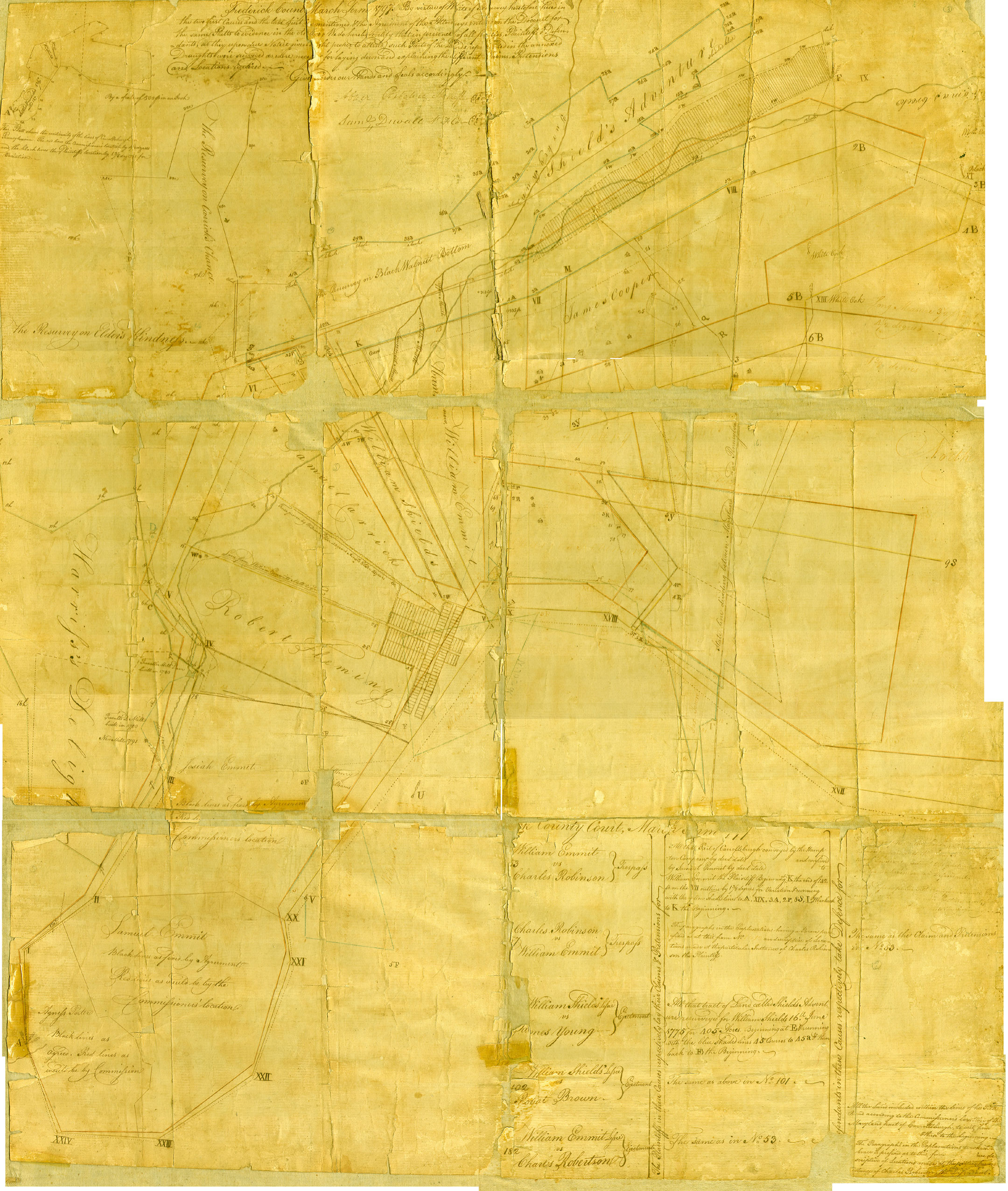
Behind an old bookcase, the couple found two maps. One
was a 1908
reproduction of an 1808 map of the town and the other was the 1797 map.
"I remember looking at it and saying to myself that
this was the Rosetta Stone," Hillman said. "This
proved everything I'd said about the founding date."
He said that the donation to the town would have some
strings attached. The map will be given in trust to the town and if at some
future date, the town decides it no longer wants to display it, it will return
to the local historical society, or if there is none, the county historical
society.
Blanchard said he hopes this is the first step to
displaying other historical items and pictures on the mostly empty walls of the
commissioners meeting room in the town office. Commissioner William O'Neil has
also spoken about adding money to the budget to create historical displays.
Historical Society note:
To view a original
size version of the map, click here

