Simply put: geology is the study of the Earth’s history, it’s physical structure and substance, and the processes that act on the Earth. Geology is part of a larger interdisciplinary study called earth sciences. Of all the hard sciences, geology is one of the least understood and appreciated sciences. Puns aside, geology is the bedrock on which
everything else rests. The physical structure and substances below and around us create the conditions for everything else. Geology is directly or indirectly responsible for shaping local climates, hydrological conditions, agriculture, biological diversity, economic conditions, and the course of history.
Rocks are split into three basic groups: igneous, sedimentary, metamorphic. The groups are determined by how the rock was formed. Igneous rocks are formed by cooling lava. They make up 95% of the earth’s crust although most are hidden under the soil and other rocks.
Sedimentary rocks are formed over long periods of sediment deposition and compression. Small eroded pieces of rock, silt, and organic materials settle at the bottom of bodies of water. Water is surprisingly heavy (weighing about 7 lbs per gallon) and over time as the weight of an ocean bears down on the debris it compresses everything together
eventually forming hardened rock.
Metamorphic rocks are formed by heat and pressure. Metamorphosis means to change. Metamorphic rocks start out as something else – usually sedimentary or igneous rocks, but sometimes other metamorphic rocks. As they’re exposed to extreme heat and pressure they change old minerals into new minerals. A good example of a metamorphic rock is a diamond.
Diamonds start out their life as graphite, a metamorphic rock that many people use every day in pencils. If graphite or other carbon containing minerals are under pressure and heat for many years they can eventually turn into diamonds.
The rocks of the Catoctin Mountain and Blue Ridge ranges came to be the way they are today through a long history involving volcanic eruptions, sediment deposition, mountain building, and erosion. About 600 million years ago (mya), this area was an ancient, eroded, granite mountain range. Then the continent separated into different tectonic plates.
This stretching formed a rift in the crust that ran through what is now Catoctin. Lava, with different chemical compositions, oozed up to the surface. This formed two different types of rock: lighter colored rhyolite with more quartz and the darker-colored basalt.
As early continents separated, a body of water called the Iapetus Ocean formed near present day Catoctin. Over the next 200 million years the land sank below sea level and rivers eroded sediment off the mountains. Overtime sediment, silt, and sand settled at the bottom of the Iapetus Ocean and compressed into sedimentary rock.
The Iapetus Ocean gradually disappeared as all landmasses converged to form the supercontinent Pangaea. The force of these collisions created faults, folds, and mountains that may have been as tall as the Himalayas. The geologic cataclysms uplifted the land, compressed, and transformed the Catoctin volcanic and sedimentary rock formations. The basalt
became a unique metabasalt, also known as Catoctin Greenstone. Rhyolite became metarhyolite.
During the Triassic Period, Pangaea began to break up. Africa and Europe moved away from North America, opening up the Atlantic Ocean. As the crust stretched large blocks of land slid downward and away from each other along faults. On the eastern side of this fault land slid downward more than a mile forming a trough we call the Monocacy Valley.
Over the next 200 million years streams and landslides have eroded the mountains that were once 15,000 to 20,000 feet high down to hills less than 2,000 feet. During the most recent Ice Age Catoctin had an extremely cold climate. Water trickling into fractures in rock outcrops would freeze. Expanding ice gradually pried apart boulders. This frost
wedging, along with the wedging action of plant roots, still contributes to the breakdown of rocks here.
Fastforwarding through to roughly 200 - 900 AD, all this geologic chaos had real, practical, timeline altering implications. Metarhyolite, formed during the formation of Pangaea, was mined by American Indians. This durable rock was ideal for projectile points and other tools. Active quarrying at Catoctin occurred from about 200 to 900 AD. Various
quarry sites and artifacts have been discovered throughout the range. Catoctin was an Algonquin word for "Place of many deer." The wooded rolling hills and valley below made an ideal range for hunting, fishing, and farming. Mineral deposits would later become an important economic driver for the region too.
European settlers began mining hematite iron ore for production in the early 18th century. An active iron works fueled industry on the mountain from 1776 through 1903. Iron from this furnace was commonly used to craft plates, stoves, cannon and musket ammunitions, and wheels. Thousands of acres of the mountain’s forest were logged to produce charcoal,
which fueled the iron furnace operation. The ruins of the iron furnace can still be explored at Cunningham Falls State Park and charcoal making sites are still displayed within Catoctin Mountain Park. Industry dried up in the beginning of the 20th century. An industrial past gave way for a future of recreation and conservation as the land was set aside becoming state and
national park sites.
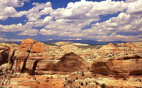
The American west is more synonymous with grand peaks and inspiring canyons. Geological history and influence is all around us though. It shapes our everyday lives, and though we usually step over and around them, rocks can transport us through time by millions of years. Geology helps us understand our planetary timeline, giving us glimpses into the
past through trapped isotopes and chemical compositions. Utilizing what surrounds us gives us materials for building civilizations. From hunting equipment to full-scale industrial outputs to providing historical atmospheric data so we can plan for tomorrow. All that’s needed is an understanding and a willingness to see what’s there, accept what we learn about it, and do with
that information what we can. Geology can be the unseen thread connecting our past to the future by utilizing the thread of understanding.